First trip report on the new blog! In which Kate and I go on a backpacking trip with a bunch of strangers from the internet and live to tell the tale! (edit: and in which I stream of consciousness write a whole lot of words and don’t edit them. You have been warned!)
I forget how it all started, but at some point, I was chatting online (seems thematic for this old-school blog idea) with a bunch of folks from the ultralight subreddit and someone said we should all go on a trip together. And then all of a sudden folks were taking time off work and getting flights and coming up with trip ideas. Since a good chunk of us were located in the PNW, a 5 day trip through the Goat Rocks solidified as our plan… until a few days before we were supposed to leave the Miriam Fire started and everything went a little haywire.
Complicating matters was that Scott and Sam were planning to do a route doing a 360 around Mt. Adams that Scott had devised immediately before the 5 day Goat Rocks trip, and they wouldn’t have cell service. But due to the uncertainties about smoke from the Miriam Fire, we were planning to call the ranger station and ask about the conditions the day before we left. If conditions looked okay, we’d go ahead with the Goat Rocks trip, and if not, we’d frantically developed a backup plan in the Alpine Lakes Wilderness.
To solve the communication problem, it was decided that Monday morning (the day before our Tuesday-Saturday trip) Kate and I would call the ranger station, get whatever info we could, make a decision with the rest of the crew still in cellphone range, then drive to Walupt Lake, where we would meet up with Scott and Sam and let them know which trip we were doing, and if necessary, shuttle them back to their car so we could all drive to Alpine Lakes.
Day 0: Driving to Walupt Lake
Portland -> Trout Lake -> Walupt Lake
We called the ranger station first thing on Monday and the ranger said that they hadn’t gotten any reports about the Miriam Fire smoke yet, but thought the wind would be in our favor and didn’t try to dissuade us from our planned itinerary. They also told us that a washout on Coyote Trail 79 that we were worried about had just been repaired. We decided to go ahead with our Goat Rocks trip with the knowledge that we might have to adapt our itinerary if the smoke ended up being bad. I also was a little suspicious that I wasn’t in good enough shape to handle our planned itinerary, but I figured, like the fire, I’d just have to adapt when the issue came up!
We had taken the bus down to Eugene the previous day to borrow my parents’ car and driven it back to Portland, so after we confirmed our itinerary with the rest of the crew, we headed out to find Scott and Sam at Walupt Lake.
We had all day to make our way there, so we took the scenic route via Highway 14 on the north side of the gorge and then headed north through Trout Lake.
When we stopped at the burger joint/coffee shop/gas station in Trout Lake, the place was swarming with PCT thruhikers, and I quickly spotted someone I followed on instagram which was a trip! After finishing our burgers, I asked the folks I recognized from instagram if they needed a ride and they did! And a short one at that! And it turns out the place Kate and I are moving in September isn’t too far from where some of them live in Portland! Making new friends already!
This was the first of many firsts on this trip for me, and I was quite tickled to give a ride to a crew of PCT hikers. Our trip is done now, but they’re still hiking and you can follow along at Homework’s blog. My cameo is in the day 5 entry posted August 7th. I’m basically famous now as far as I can tell.
The rest of the drive was pretty low-key, and we found Sam and Scott sprawled out on the side of the road about a mile from Walupt Lake and gave them a ride the rest of the way. We got a car camping spot at the lake and set up our shelters and fed them snacks and beer as they recovered from their Adams 360 adventure.
Day 1: Big climb to Goat Lake
Walupt Lake -> Nanny Ridge Trail 98 -> PCT -> Snowgrass Trail 96 -> Goat Lake
On Tuesday morning, the rest of our crew started rolling in, and soon the 9 of us were gathered at the trailhead ready to tackle a big climb up Nannie Ridge Trail 98. 1900 ft of elevation gain over 2.4 miles got us all sweating right off the bat. The heat didn’t help either. Eventually we joined up with the PCT and started seeing a fair number of other hikers.
We all got a chuckle when a group of thruhikers said we were the most ultralight sectionhikers ever, and Sam demoed his footcare system to a hiker who was having trouble with their blisters, complete with taking off his shoes and getting out the leukotape.
Shortly after Cispus Pass, and as we were all just about to melt from the heat, we came across a small streamcrossing with a waterfall! Our group had gotten pretty stretched out at this point, as we were all hiking different speeds, but we collected up at the waterfall, where the cold mist made the area significantly more pleasant. We lingered as long as we could, but eventually it was time to move on, heading towards the cutoff that would take us off the PCT and onto Snowgrass Trail 96 towards Goat Lake.
Most of Tuesday was spent walking through charming alpine meadows, with small patches of conniferous trees and views of high peaks in every direction. It was gorgeous.
During the last mile or so of the hike, my knee started to hurt on the downhills. This was immediately worrying and frustrating! I’d done an overnight a few weeks back with similar mileage and elevation to this first day and my knees had felt amazing. But now my right knee was hurting. I tried not to stress too much about what it meant for the rest of the trip, and slowly picked my way down, then back up to Goat Lake where we were planning on camping.
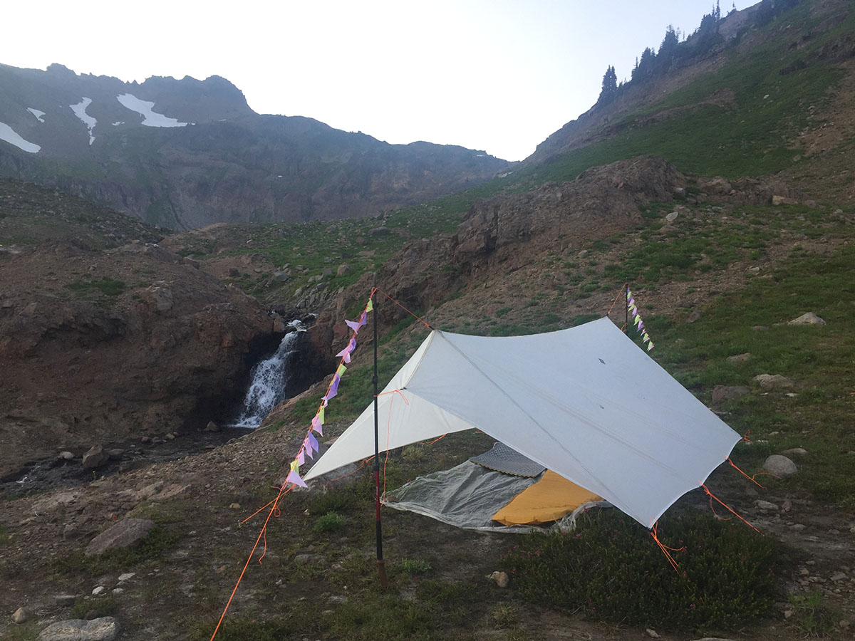
Goat Lake was gorgeous, surrounded by mountains and with a few icebergs hanging on late into the summer. The wind coming off the lake was cold, and Scott set up his shelter on the shore while the rest of us headed back down a few hundred feet to set up where it was slightly warmer.
After making our pesto pasta salad (cold soaked ramen with pesto sauce) for dinner, we crawled under our tarp and wrapped up in our quilts and, aside from the knee, I was feeling great.
Day 2: The adventure begins
Goat Lake -> Snowgrass Trail 96 -> PCT -> Coyote Trail 79 -> Upper Lake Trail 81 -> Packwood Lake
Either in the morning, or the previous evening, we decided that rather than take our planned loop down Goat Ridge Trail 95 then back up Snowgrass, we would just head straight back to the PCT and onwards towards the knife edge and perhaps end up camping at Lost Lake. This would cut some miles off both today’s and tomorrow’s itineraries, which was fine by me, since my knee hadn’t magically fixed itself overnight.
We started off and Kate and I quickly fell towards the back of the group as I was walking slow and taking a lot of breaks. I found that if I hiked slow for an hour, then took a 20 min break to rest my knee and stretch my legs, I felt like I could keep on hiking without things getting worse. We played leapfrog with Chris, whose feet were hurting and was also taking it easy. Kate gave me her trekking pole, so I could hike with two poles for most of the day (we had each been using one pole up until this point).
Day 2 was full of big alpine views, which was pretty dang cool! And the big alpine views was what several of our friends who had flown across the country were most excited about for this hike!
Either just before, or at the beginning of the knife edge (I’m not sure where it officially starts) there were a few snow crossing. Most of them were fairly low-key, although you definitely had to pay attention, and I gave Kate her trekking pole back so we each had a pole for the snow. But the middle one felt pretty scary. I don’t have a lot of experience evaluating snow crossings, but this one was pretty clearly of the if you fell it would be real bad variety, and while there were footsteps to walk in, they didn’t feel super secure. I’d been walking in front because I was slower, with Kate behind me, and that turned out to be good on this section because about halfway through the scary crossing Kate said her adrenaline was really starting to pump and she could feel the impulse to go faster which she knew of course was not a good idea, so I continued to walk slow, and we kept up a conversation about nothing, trying to strike a balance of still focussing intently on our foot placements, but also offering something else to focus on to take the edge off the adrenaline.
We made it through the snow without incident, and tried not to dwell too much on the fact that our planned itinerary had us doing these crossing again at the end of the trip. After the snow came the knife edge, which was gorgeous. Kate was a little distracted by the aftereffects of the adrenaline, and I was a little distracted by worrying about my knee, but the views on the knife edge were breathtaking.
After the knife edge, we were hiking with Matt, and as he hiked up a small rise in front of us, he turned around and shouted back, “You’re not gonna like this.”
As we crested the rise we saw a lot of smoke far of in the distance from the Miriam fire. But then we saw what he was pointing at, a brand new plume of smoke in the valley that our itinerary had us passing through the following day. We had already been a little bit hesitant of our plan to hike back on the Clear Fork trail, just becuase of the smoke, but this sealed the deal. We were going to have to reroute.
Unfortunately, Chris was somewhere behind us, Spencer, Sean, Sarah and Sam were all up ahead of us, and we were fairly sure that Scott was behind us, but hadn’t talked to him since the morning when he was heading off to explore Hawkeye Point and planning to catch up with us later.
We pulled out our maps and phones and concluded that the smart thing to do would be for everyone to keep hiking on our planned route for a few more miles, then gather at Packwood Saddle, where we had an option of hiking out down to Packwood Lake, or perhaps camping in that general vicinity, and doing an out-and-back of the trails we had already hiked. We just hoped the rest of our friends had come to the same conclusion!
Thankfully, they had, and when we finally made our way to Packwood Saddle, everyone was waiting, tired, thirsty, and being swarmed by flies. The flies didn’t seem to be the biting kind at least, so that was a bonus!
After a fair amount of discussion, it was concluded that most folks were more interested in hiking down to Packwood Lake and either figuring out how to string together a bunch of winding forest roads and connect back up with the Lily Basin Trail. We’d camp at the beginning of the Lily Basin Trail, then hike back to Goat Lake the following day. Or alternatively, we could hitch into the town of Packwood, then from there hitch back to our cars at Walupt Lake.
After we’d decided we were commited to camping down at Packwood Lake, the folks who were suffering the most from the flies headed down towards the lake, and the rest of us waited for Scott and Chris to pass on the decision.
During all of the waiting and flies and sitting around at Packwood Saddle, Sam had deployed the pro move of rolling out his CCF pad and taking a nap with his backpack as a pillow. That was definitely a pro move!
Eventually Scott and Chris showed up, and the plan was communicated, and Kate and I headed down towards the lake while Scott and Sam made dinner in Packwood Saddle.
Kate and I played leapfrog with Chris for a while, and eventually Scott and Sam zipped by us. We rolled into camp a little after sunset, and thankfully were able to hear voices and spot the flimmer of headlamps reflecting off of Cuben Fiber in the dark to find our friends. Chris rolled in a little later and we all saw his headlamp and shouted to make sure he didn’t miss us.
After a long and exhausting day, especially with the added stress of nursing my injured knee along, we were rewarded with a warm and miraculously bug free night. Kate and I decided to skip setting up our tarp and cowboy camp, which was great fun, and was something we’d never done before. Falling asleep on our sheet of polycryo, staring up at the stars and tree branches was delightful.
Day 3: Hitchin’, wheelin’, and car campin’
Packwood Lake Trail 78 -> Packwood -> Walupt Lake -> Packwood -> Car camping off the side of the road
The following morning, we hiked out towards the Packwood Lake trailhead, which was about 6 miles away. Initially, Matt and Chris were planning on hitching into Packwood and taking it easy and eventually hitching their way back to Walupt to meet us at our cars Saturday, while the rest of us would hike the forest roads to connect to the Lily Basin Trail.
My knee continued to hurt, but thankfully wasn’t getting any worse as we hiked this morning. It did mean I was hiking a lot closer to 1 MPH than my usual 2 MPH however.
When those of us who were planning to head to Lily Basin all collected at the trailhead, we sat down and tried as best we could to count up the mileage of forest roads to make the connection. Initially we had hoped to be able to make a shortcut and bushwack from one road to another at one point, but a closer look at the topography ruled out that idea.
Because of how the roads twisted and turned, it ended up looking like around 12 miles of forest road walking to get to where we would be camping at the beginning of the Lily Basin Trail.
At 2 MPH, we could get there by nightful, but I knew I couldn’t keep up that pace for 12 miles, and I told the group that at the pace I’d been hiking, it would probably take me until midnight to make it to our destination, so that was basically a no-go for me, and I’d have to hitch into Packwood. Everyone was very understanding, and decided to hitch to Packwood as well rather than split up further. And no one had been particularly excited about spending the whole day walking winding dirt roads in the forest.
While we had been hemming and hawing about our plans, we turned down a hitch with a big church group, and of course we decided that we did indeed want a hitch immediately after they pulled out of the parking lot. Serendipitously, Matt and Chris emerged from the trail behind us and we were all reunited, now that we were all heading to Packwood. We eventually all managed to hitch into Packwood in a series of small groups, and while there was no cell service in Packwood, we all collected up at Cruiser’s pizza, as that seemed to be the obvious gathering place. We had burgers and pizza and beer and chitchatted with the PCT hikers who were refueling and charging their batteries while we planned our next moves.
After a few failed attempts at the coffee shop and gas station looking for a ride, Kate managed to score a ride back to Walupt Lake from the owner of the ski shop next door. It was incredibly generous of him, considering he closed his shop early to drive us an hour back to our cars! Kate, Spencer and I went with him, so that we could then drive two cars back to Packwood to pick up the 9 of us, and then drive us all back up to Walupt. There was a lot of driving ahead of us, but it felt great to have some plans nailed down finally.
This was my first time hitching a ride, and I started using the list of firsts for me on this trip as a great way to keep my spirits up while struggling with my knee.
Walupt Lake campground was totally full, so as we drove back, we kept our eyes out for dispersed campsites on the side of the road where we could car camp before heading out again to do one more night of backpacking.
When we got into town, everyone hit the grocery store, and we tried to buy fun food for car camping. Car camping is a skill that most of us don’t have all that well developped, but we did our best, with a lot of chips, guacamole, and beer being purchased.
Then we headed back up the road to Walupt Lake for the 3rd time that day, and began to search for a campsite. There were a few scares about our creeky old cars overheating, and a bit of smoke that was concluded to just be my parents’ car that we had borrowed burning a little oil.
We explored a few side roads looking for campsites and Scott and Sam gave me instructions about how to not high-center the car, and how to drive over large rocks, which was another first. Presumably, this didn’t count as off-roading, becuase, for one, we were on a road, but for a city-dweller like me, it felt pretty dang adventurous! Unfortunately, the adventurous routes to campsites were all a bust, and we had to back track, and eventually made our way to a pretty nice spot just off the road that we had spied on our way down. There was a big open area where we could park the cars, watch the stars, etc., and tucked away behind us was a stream, and some softer ground for setting up shelters.
We learned that in addition to my knee being hurt, and Chris’s feet being one giant hotspot, Chris had had been a bit sick in Packwood, Sarah had gotten stung by a bee while waiting for us to return with the cars, so a low mileage day and a night of carcamping seemed like it was just the thing many of us needed.
Despite the comedy of a group of ultralight backpackers trying to car camp, we all had a great time hanging out and eating chips before rolling up into our little hiker burritos and cowboy camping and watching the stars.
Day 4: Mt. Adams High Camp
Walupt Lake -> Killen Creek Trailhead -> High Camp
In the morning we decided that we’d head to Walupt Lake to collect Chris’s car, and he’d probably head out, since his feet were beat up, then we’d all make our way towards the Muddy Meadows trailhead where Scott’s car was, and from there head to the Killen Creek Trailhead on Mt Adams and hike up to High Camp.
Sam decided to head back into Portland since he’d already done this hike at the beginning of the week and he needed a little time to get his stuff organized before flying home.
Scott graciously played tour guide for us as we hiked up to high camp. We’d done this same hike with Scott a few weeks earlier when he was scoping out different parts of the Mt Adams route, so we took it slow and the rest of the group raced ahead.
The hike from Killen Creek to High Camp is relatively short, but the views are incredible. The views/effort ratio is really off the charts, and I highly recommend it as an overnight trip for anyone in Portland or nearby.
When we’d done the trip with Scott, we’d camped SE of high camp in a cool flat area, and we met the crew up there, but it was concluded that it was a little too windy and there weren’t quite enough spots for all our shelters. My knee didn’t feel quite up for the side trip to Lake 7505, so I had to pass on that, but we’d gone up there on our trip a few weeks back and it was gorgeous. I definitely recommend making your way up to the lake if you do this trip! Sarah also joined Kate and I in heading back down to high camp rather than heading up to the lake since she was suffering from a combination of a headcold and the bee sting on her ankle was pretty swolen and uncomfortable.
After much hemming and hawing about where to find wind breaks to set up our shelters, we eventually set up at high camp and relaxed. The Perseids meteor shower was getting going this evening and we saw some great shooting stars.
Day 5: Heading home
High Camp -> Killen Creek Trailhead -> Trout Lake -> Portland
Heading home was largely uneventful, but still a nice hike, and my knee continued to maintain the status quo, which was reassuring. We feasted in Trout Lake, and eventually made our way back to Portland.
Between my knee starting to hurt on the first day, reroutes due to fires, having to hitch to Packwood, then to Walupt, struggling with finding a campsite, and generally communicating and balancing the needs and desires of 9 different hikers, there were a lot of challenges on this trip. But it was also absolutely amazing and I had a blast. As Sam said several times, “that’s what makes it an adventure!”
Now that I’m home I’m trying to figure out how to help my knee heal and how to get stronger and be less injury prone. Hurting my knee was hugely frustrating, as we’d gone on a trip recently that we thought had similar mileage and elevation as the rist two days on the Goat Rocks trip, and my knees had felt fabulous. So I’m not entirely sure what the difference was. Perhaps there was more rocky ground in the Goat Rocks that subjected my knee to more forces in unusual directions.
Regardless, my gameplan is to rest my knee and work my butt. A lot of what I’ve read about the knee pain I had seems to indicate that weak glutes are a potential culprit. Weak glutes are also a common affliction of folks who work desk jobs, which I do. So I’m gonna keep up the yoga I’ve been doing, and add in a kettlebell workout, specifically focussing on kettlebell swings to target my glutes, then slowly ease back into hiking.
At the very least, if it doesn’t end up helping with the knee, it should help me develop a great ass, so I figure it’s a win either way.
If you made it all the way through this, thanks for reading my first trip report!
I’ll do another post with some thoughts about gear and that sort of thing.
I’ll also try and add some photos, but just writing this up ended up taking way longer than I expected, so for now, this is it!
Also, for another perspective of the trip, check out Sean’s videos: Part 1 and Part 2 on youtube! I think Sam may have a trip videos coming up as well.